If you have forgotten much of whatever you knew about maps in general, try Maps - Fundamental
The Earth is a three-dimensional object. To locate a particular place on Earth we can specify three pieces of information:
A map is a two-dimensional representation of a three-dimensional object. Distortions occur in going from three-dimensions to two-dimensions and different map projections have been devised. Spend a few minutes at the The Great Globe Gallery. Look at some of the projections and other views that seem interesting.
A map needs a scale that allows the user to determine the distance between two (or more) places on the map. In addition, orientation of the map needs to be indicated by showing the direction to the North Pole. A compass points to the North Magnetic Pole (which is not located at the North Geographic Pole) The deviation between these two poles (the magnetic declination) should be shown on the map. Try Finding Your Way with Map and Compass .
A Topographic map shows the variations in elevation of the area represented on the map with contour lines. A contour line on a map connects points that are at the same distance above, or below, sea level (or some other reference surface). For example, the 20' contour line connects all points on the map that are exactly 20' above sea level. For each map a contour interval is selected; this is the vertical distance between adjacent contour lines. If the contour interval is 10', then the next highest contour line is the 30' line and the next lowest is the 10' line. If a point on a map is between the 20' and the 30' contours all you know is that the point is greater than 20' above sea level and less than 30' above sea level; you can not "guess" the exact elevation.
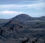
The spacing of contour lines on a map tells you how "steep" the slope is. If you had a map of a "dome" (an upside down bowl) the contour lines would be equally spaced around the dome. If there is a high with a very steep side and a very gentle side, the contour lines would be very close together on the steep side and further apart on the gentle side. Thus, a topographic map allows your to "see" the features present on the surface that are being represented.
In drawing a profile, you will select the vertical scale. Ideally, the vertical scale and the horizontal scale (as controlled by the map) should be identical. However, in many areas, this results in a nearly "flat" profile. A common practice is to exaggerate the vertical scale to portray the variations in relief along the line of the profile. For example, the scale on a map might be given as 1:62,500 which means that one unit on the map equals 62,500 of those units on the ground. Or, 1 inch on the map equals 62,500 inches on the ground. This is approximately 1 inch on the map equals 1 mile on the ground. What would be the exact scale if 1 inch equals 1 mile? A profile made from such a map would have to have a vertical scale of 1 inch equals 1 mile or (approximately) 1 inch = 5,000 feet. If the relief in the area is much less than 5,000 feet, the profile would be nearly a flat line. You might elect to let 1 inch equal 100 feet. The vertical exaggeration is: 5000/100 = 50X.
The faculty at Cavin College have constructed a nice introduction to Topographic Maps. Spend some time reviewing the properties of these maps. Then, take the Quiz.
There is nothing to hand in but write me a brief paragraph in which you tell me if you find it easier to learn interactively (with aids like the Calvin College example) or if you prefer a text book approach. Please send me your statement via e-mail.
Print a copy of the topographic map of Mt. Fogo. Answer the following questions and hand them in on the date listed on the assignment list.