Begin by considering the following commentaries on the state of the Earth's coastal zones.
The overall goal of the Texas Shoreline Change Project "is to establish a state-of-the-art regional shoreline-monitoring and shoreline-change analysis program that will help solve coastal erosion and storm hazard problems along the bay and Gulf shorelines of Texas." [The following summaries are taken from the Bureau of Economic Geology's report on the Gulf of Mexico Shoreline Change from the Brazos River to Pass Cavallo].
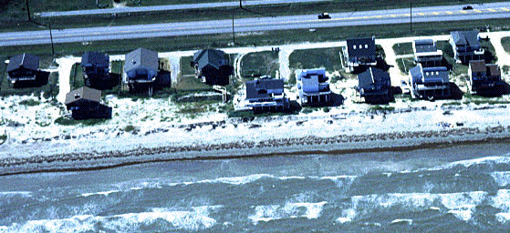
"The natural character of sandy beaches is to change shape constantly and to move landward (retreat) or seaward (advance). The changes are caused by changes in the forces that move the sand, namely wind, waves, and currents, and by the supply of sand. Short- and long-term relative sea-level changes also control shoreline movement.
The setting of the shoreline and the supply of sand determine how the shoreline changes at a particular location. Setting refers to whether a beach is sheltered from waves, adjacent to a tidal or storm channel, or next to a jetty or seawall, to state a few examples.
To understand and predict the rate of change, we need to distinguish between long-term, short-term, and episodic changes and to understand their causes. Long-term change occurs over tens to thousands of years, short-term change refers to movement occurring over several seasons to 5 or 10 years, and episodic change is that which occurs in response to a single storm. "
The natural geologic setting has not left much sand offshore to resupply eroding beaches either. Generally the sand turns to mud less than about 4 km offshore. Thus the natural geological setting of the upper Texas coast has created a shoreline that is low in sand supply and that is undergoing long-term relative sea-level rise. For these reasons, the shoreline will continue to undergo long-term retreat unless human intervention prevails."
Kent Kirkby of the University of Minnesota and his colleagues have developed a series of interactive animations to illustrate the effect of rising sea level accompanying melting of some portion of the polar ice caps. He estimates that melting all of the glaciers on Earth would result in a sea level rise of some 60 to 80 meters. Spend some time exploring the effects of Sea Level Changes.
It is important, however, for coastal residents to understand that even though a particular beach may have been advancing or stable over the last several years, if it has been retreating for the previous decades, then retreat will eventually resume. An exception to this rule would be if something fundamental, such as a "permanent" increase or decrease in the sand supply, has changed in the system."
Spend some time exploring the effects of Short-Term Changes in the coastal zone.
Even though shoreline change rates are given as annual rates, they must be considered "average" annual rates. A particular shoreline with a long-term retreat rate of 2 m/yr would be expected to be 120 m landward in 60 years. A single storm, however, could cause much of this movement."
Spend some time contemplating Episodic Changes in the coastal zone.
In this role playing exercise you are a member of the Freeport Region Coastal Zoning Commission. Condos-R-Us is proposing to develop a Condominium project about 2 miles south of Freeport, Texas and approximately 400 feet from the Gulf of Mexico. They argue that this section of shoreline has undergone a net accretion of nearly 1,200 feet since 1852; approximately 10 feet per year. Development funds have been raised and all that remains to start construction is the issue of the building permit.
Parks-We-Be, a local citizens group has raised some concerns about the data used by Condos-R-Us and their interpretations.
You will cast the deciding vote when the Zoning Commission meets next week. Begin Your Deliberations