Heat, High Water and the Quest for Answers
Researchers from across campus are studying our changing climate, with an eye on the future
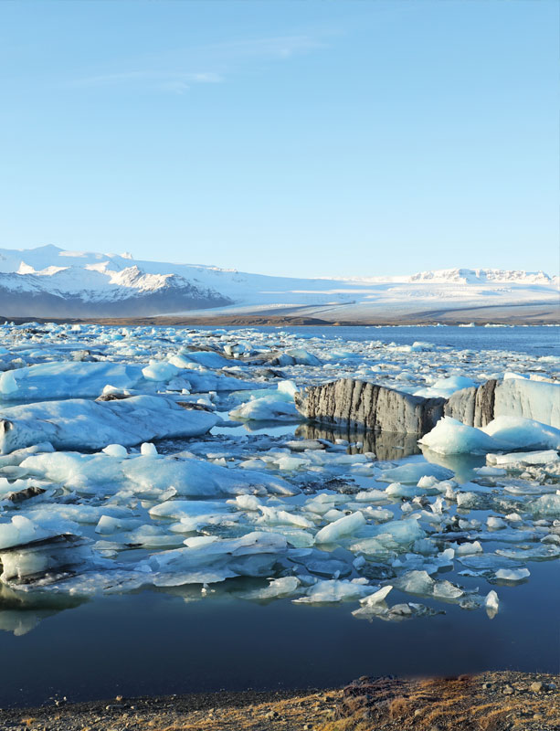
Houston’s steamy summers are a long way from the Antarctic ice sheet, but that’s where Yuribia Muñoz goes to work, collecting samples of sediment spewed by the southernmost continent’s fabled glaciers as they retreat in response to a warming climate.
“The ice is melting really fast,” she said. “We think changes are happening even faster than we previously thought.”
Clues trapped in the sediment may explain why and, more important, offer ideas about what to expect in the future, the common thread in multidisciplinary climate change research at the University of Houston.
Some studies predict Houston and the Gulf Coast will be among the country’s hardest-hit regions as climate change continues, and – from sampling the glacial sediment and scanning the permafrost in Antarctica to studying soil diversity and mangrove expansion along the Texas coast – researchers here are focused on expanding our knowledge and offering a roadmap to the future. Their work is global in scope, even extraterrestrial. But what they learn can inform decisions made closer to home at a time when the environmental and financial impact of the changes – more heat waves, more drought, more flooding – is beginning to receive increased attention.
Liming Li, an assistant professor of physics, studies the climate on Jupiter, Saturn and one of Saturn’s moons, which could offer information about the past and future climate on Earth. Don Van Nieuwenhuise, director of the professional geoscience program in the College of Natural Science and Mathematics, recently published work from the Gulf of Mexico that shed new light on an episode of extreme warming more than 55 million years ago, with potential implications for today’s climate.
Not everything requires monitors and lab equipment. Tracy Hester, an environmental lawyer and lecturer at the UH Law Center, works on compliance and policy issues related to climate change regulations, for example, in addition to teaching a course on climate change law and litigation. He also organizes workshops and symposia on how new climate regulations will affect energy production in Texas, how planning for climate change will affect Texas water supplies, the potential impact of U.S. and international climate litigation and emerging theories of climate liability. Hester also is editing a book on the law of climate engineering, partnering with Michael Gerrard of Columbia Law School.
But much of the climate research here involves study of a natural world in the midst of change.
Steven Pennings, an ecologist and professor of biology and biochemistry, has several projects involving coastal regions, including a study of mangrove expansion at Port Aransas. In the past, winter freezes kept mangroves in check along the Gulf Coast, but pockets of the trees, which grow in salty water, are spreading as hard freezes occur less often. “We don’t know how things will change as the coast changes,” he said. “Our question is not, are they spreading? We know they are spreading. It is, what are the consequences of that?”
Mangroves, Salt Marshes and Soil
Twenty-six years ago, when Pennings completed his Ph.D. in ecology from the University of California-Santa Barbara, climate wasn’t on the radar of anyone in the field. “Now,” he said, “almost any ecology student is thinking about it all the time.”
And as data from long-term studies set up 10 or 20 years ago begins rolling in, the impact is becoming clear. While the natural world is always evolving, a more rapidly changing climate may speed up those transitions. One concern, Pennings said, is that change might outstrip nature’s ability to keep up – plants may migrate across the continent in search of the right weather conditions, but the factors needed for a healthy plant population, including natural seeding, may not evolve quickly enough.
Pennings’ mangrove study, funded by the National Oceanic and Atmospheric Administration, is set about 200 miles down the coast, at the Mission Aransas National Estuarine Research Reserve. Ten plots of mangrove-thick coastline, each about one-third of an acre, were groomed in gradually more dramatic fashion, forming a gradient from fully covered by the salt-water trees to a plot from which all the mangroves had been removed. Over the past four years, some results have been tallied: the section with the mangroves completely removed has filled in with marsh groves, and research is underway to study the effect on soil, crabs and other small animals, insects, birds and what scientists call the “microclimate” – the temperature, wind and other variables within the plots.
Temperatures are coolest at the extremes – both no mangroves and fully covered – and warmer in plots with intermediate density. Soil is building up more slowly in plots with no or fewer mangroves, important information as scientists consider rising sea levels. More mangroves mean fewer birds.
But most of the results don’t fit into neat boxes.
“It’s complicated,” Pennings said, but a better understanding of how birds, fish and other sea life are affected will directly impact the state’s economy, which depends in part upon people visiting the coast for fishing and birding.
Related work along the Georgia shore considers sea level rise, changing rainfall patterns and varying amounts of freshwater pouring from rivers into the bay. The Georgia Coastal Ecosystems Long Term Ecological Research Program started in 2000, funded by the National Science Foundation. Pennings studies the saltmarshes. Plants are stressed or killed, and the composition of soil changed, when drought and other conditions limit the amount of freshwater flowing into marshes, he said. Rising sea levels push more salty water upstream.
That will matter in Texas and other coastal states, he said, as scientists determine how much saltwater intrusion the plants can survive.
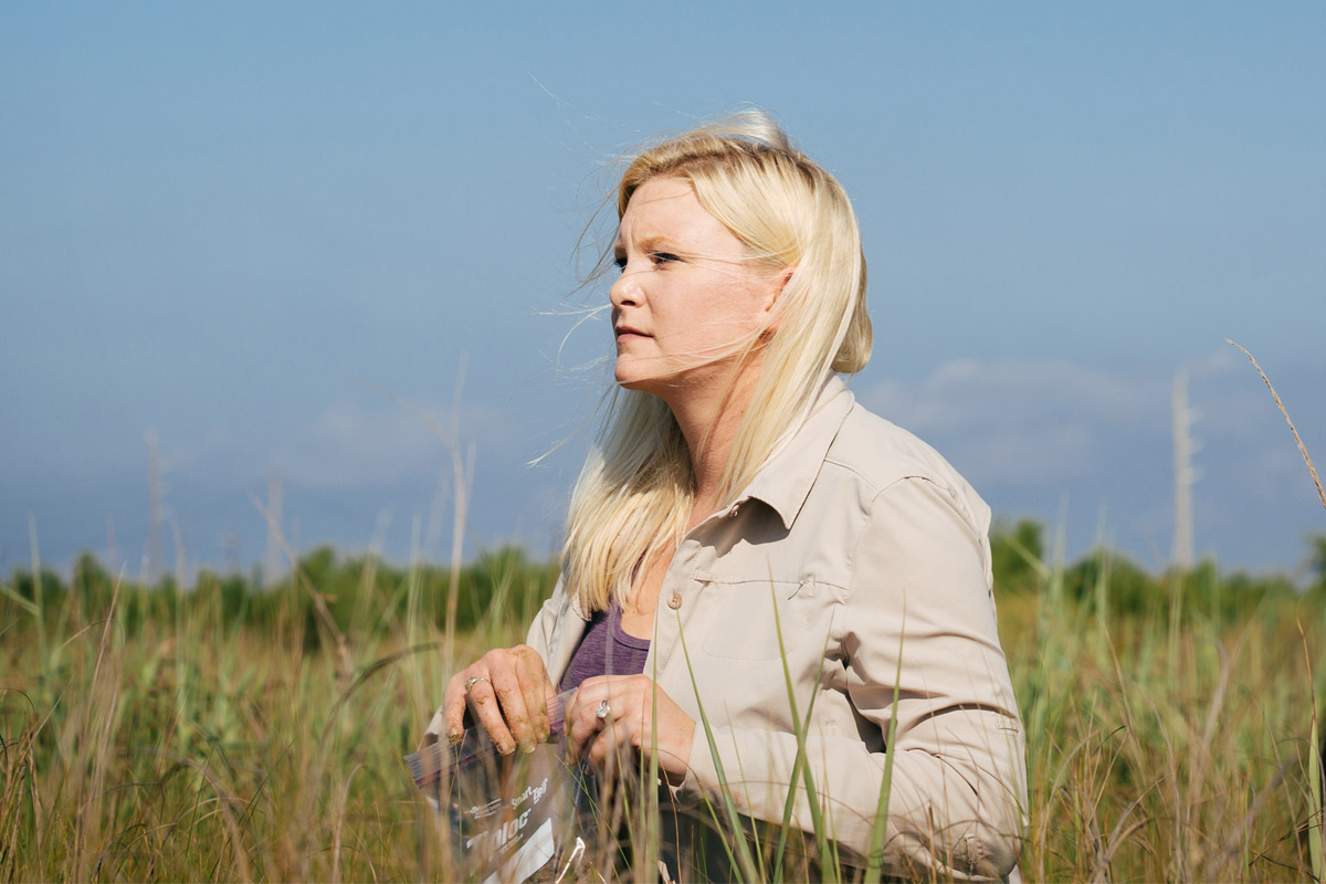
Kerri Crawford is looking at coastal regions, too, albeit through a different lens. Crawford, assistant professor of biology and biochemistry, studies plant-soil microbial interactions and whether a changing climate will alter plant diversity. If so, some plant species could become extinct, she said, while non-native species could run rampant. A drop in plant diversity could lead to more disease outbreaks in the soil, which would hurt native plants, wildlife and, ultimately, farm crops.
Mostly, Crawford said, it matters because plants are the basis of food webs for all species, including humans.
Soil plays a key role in many ecosystem functions, including regulating growth, nutrient cycling and sequestering atmospheric carbon dioxide. The heart of Crawford’s work is discovering what influences the soil’s ability to perform those functions.
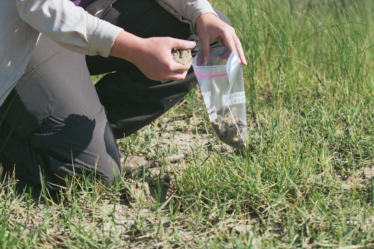
Texas soil is expected to be drier in the future, and Crawford and graduate student Anna Hawkins collect soil from the UH Coastal Center, located at a former military installation about 35 miles south of campus, to learn how it interacts with plant species and how the interaction is influenced by changes in climate.
Microbes in drier soils limit growth, Crawford said, suggesting climate change will have a negative effect. That wasn’t a surprise; she expected less moisture to be linked with reduced growth. But the reason for the link – whether drier soil changes the microbes in that soil, or changes how the microbes interact with the plant – could have implications for maintaining plant diversity.
Plant diversity isn’t a matter of aesthetics or saving a favorite species of tree. “Pollinators rely on diverse plant communities,” Crawford said. “A lot of the animals people care about rely on that plant diversity. If we see a loss in plant diversity, we’re going to see a loss in animal diversity.”
Soil microbes may even influence coastal safety. Funded by the Texas Sea Grant program, the Crawford Lab recently began studying how soil microbes could influence the outcomes of dune restoration. Most restoration projects use sand dredged from the sea floor, but that sand doesn’t usually contain microbes associated with plant growth, which is needed to stabilize the dunes. Adding microbes to the restored dunes could help, but Crawford said the type of microbe could help ensure invasive plants don’t crowd out more valuable species.
“It comes down to resilience,” she said. “If adding soil microbes does help, will it be a level of protection that can help us to manage sea level rise?”
Tracking Carbon Dioxide and Methane
The terms “climate” and “weather” aren’t interchangeable – NASA notes that “weather” describes atmospheric conditions over a short period of time, while “climate” refers to what happens over a longer period.
That’s why all those “How come it’s snowing if climate change is real?” questions miss the point. But the climate does affect day-to-day conditions, and Xun Jiang, associate professor of atmospheric science, is part of a NASA-funded team of scientists measuring levels of carbon dioxide across the globe.
Carbon dioxide, or CO2, is the most common of the so-called greenhouse gases, which trap heat near the earth’s surface. While there are natural sources of CO2, most is produced through human activities, primarily by the combustion of fossil fuels – oil, natural gas and coal – for electricity generation and transportation.
Jiang began studying CO2 data as a post-doctoral fellow at NASA’s Jet Propulsion Laboratory, when NASA launched its Atmospheric Infared Sounder instrument in 2002. Current data is gathered through the Orbiting Carbon Observatory (OCO-2), which launched in 2014 and was NASA’s first spacecraft dedicated to studying atmospheric carbon dioxide.
She uses the satellite data to calculate CO2 abundance, which is used to determine whether CO2 is increasing and how quickly. “People are interested in trends,” she said. “The level may vary year to year, but on average, we see CO2 increasing about two parts per million per year.”
A second group of scientists uses the data to make future predictions.
The United Nations Framework Conference on Climate Change agreed last year to limit the rise in global average temperatures to less than two degrees Celsius above pre-industrial levels and to achieve net zero annual emissions of greenhouse gases by the second half of the century.

That’s policy, Jiang noted. She focuses on data. “Global-distributed CO2 data from the satellite can monitor CO2 from space and provide useful information on the location of CO2 sources and sinks,” she said.
A second NASA grant supports Jiang’s work in extreme weather and the relationship between greenhouse gases and the water cycle. “The wet areas (around the globe) get wetter,” she said. “Dry areas tend to get drier. Our investigations suggest that global warming due to the historic increase of greenhouse gases can influence variations of precipitation.”
In recent years, methane, or CH4, has gained attention as people have switched to natural gas because of its touted climate benefits. Natural gas burns more cleanly than other fossil fuels, producing more energy per CO2 molecule than oil or coal. But natural gas is primarily methane, which is potentially far more damaging to the climate.
A landmark study by Robert Talbot, professor of atmospheric chemistry, measured methane emissions across the Barnett Shale in North Texas and found that some natural gas wells, compressor stations and processing plants there leaked far more CH4 than previously estimated.
The work, part of a series of studies coordinated by the Environmental Defense Fund, with funding from the Alfred P. Sloane Foundation, found that a few individual sites had very high methane loss rates – high enough to make natural gas from these sites worse for the climate than coal in the short term.
But in another recent study, Talbot and researchers in his lab, including doctoral student Lei Liu, found a rare bit of good news related to the warming planet: climate change – in the form of a stronger sea breeze, the result of warmer soil temperatures – contributed to the drop in high-ozone days in the Houston area. The U.S. Environmental Protection Agency in 1997 classified Houston as a “severe” nonattainment area due to ozone levels measured over an eight-hour period. By 2008, the city was classified as a “moderate” nonattainment area.
“We weren’t looking at it from a climate change perspective at first,” Talbot said. “Then once we saw it was the sea breeze, we knew it had to be climate.”
Exploring and Interpreting Antarctica
For Talbot, like Jiang and many of the other researchers, the goal isn’t to promote a particular policy but to ensure policymakers have access to accurate information. That drives Muñoz, too, although she also shares a second motive with other researchers: scientific curiosity.
“I really like understanding the Earth,” she said.
And there is a lot to try to understand, even in isolated Antarctica. Why is the continent covered in ice, when the North Pole is not? (Scientists know the answer to that: Antarctica is an ice-covered land mass, while the North Pole is covered in floating ice. Ice melts more quickly in water than on cold-trapping land.) And have increased Antarctic temperatures caused the underlying ice trapped in the permafrost to melt?
That last question was addressed when researchers with the National Center for Airborne Laser Mapping, a research center funded by the National Science Foundation and based at UH, used LiDAR – or light detection and radar – technology to map Antarctica’s McMurdo Dry Valleys. Muñoz’s work with Julia Wellner, assistant professor in the Department of Earth and Atmospheric Sciences, considers how Antarctic glaciers have retreated over the past 100 to 200 years – that’s considered “recent” in geologic time – as well as how the ice sheet responded to high CO2 levels in the past. Wellner's lab is funded for the work by the National Science Foundation Polar Programs division.
Muñoz has traveled to Antarctica twice, first as an undergraduate in 2010 and again last year as a graduate student working on a Ph.D. in geology. The 2015 trip took her to the Ross Sea, collecting samples of sediment to learn more about how the area has changed.
Some glaciers have retreated more than others, she said, despite sharing the same climate. “If the entire area is warm, and the entire area is covered by ice, there must be something else at work,” she said.
Changes in the sediment – some of the core samples reach 85 feet below the surface, while others are just five feet deep – offer evidence of past movement, as scientists study signs of marine algae and animal life in the samples.
“There are clues that tell us where the ice was at certain times,” Muñoz said. “If we’re lucky, we can tell the age of the sediment and track how far the ice has moved.” Other scientists use that information to predict future glacier behavior.
The rate of melting has accelerated, even though CO2 levels have fluctuated before, she said. “We think it’s changing too fast for it to be reacting solely to long-term cycles.”
Understanding not only how glaciers are moving but why will have applications in Texas and the rest of the world, especially for cities – like Houston – near the coast.
“We’re not accommodating the change,” Muñoz said. “We’re not capable of adjusting to the change fast enough. If sea levels rise, we won’t have time to move away from the coasts, to change our infrastructure.”
Next Story:
Emerging Research
College of Education professor among the first to research issues related to LGBT.